Distance :
35.22km
Difficulty :
Easy
Duration :
8h 52
Elevation gain :
520m
Elevation loss :
515m
Starting point :
50.166168,4.182434
Description
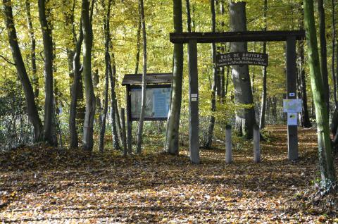
The second starting point for the great crossing, Sivry is an ideal place for nature tourism, thanks to its wooded landscapes. The itinerary for the great crossing assumes a rustic element with its scrub-like hedges. You will follow a short stretch of the Véloroute des lacs, a bike path that runs between the Eau d'Heure lakes and the lakes in Val Joly in France to reach Bois de Bruyère. You will eventually pass through the villages of Sautin and Rance, before reaching the former train station in Froidchapelle. This relaxed route soon bypasses the Eau d’Eppe and begins to pass through Bois Robert. The great crossing runs across the Fagne de Chimay, a vast schist depression with poor-quality soil, for a few kilometres. Upon reaching the village centre in Virelles, you will join the Virelles-Nismes section of the great crossing. Two camp sites are located in this section: the Frès camp site and the Bois de Hernoy camp site.
Ardennes-étape Privilege
Loading...
With your reservation, you automatically receive one month of Premium access to SityTrail, a GPS app that allows you to discover lots of great trails near your holiday home!
How do you activate your free access to SityTrail?
- Go to your customer account, Benefits section
- Click the link to create your account on the SityTrail website
- Download the app
- Explore the Ardennes!
Altimetric profile
Explore the surroundings